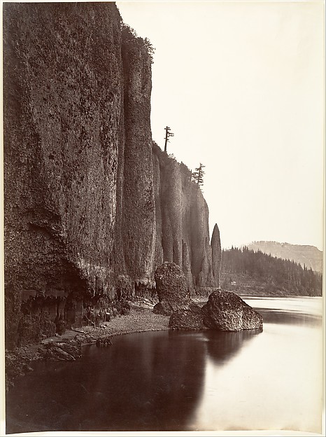
Cape Horn, Columbia River, No. 1229 from the series "Watkins' Pacific Coast"
1867
Albumen print, stereo
8 × 7.7 cm (3.1 × 3 in)
SEE IT IN PERSON
Not currently on view
In the collection of Art Institute of Chicago, Chicago · as of July 2026
Discussion
Be the first to share your thoughts.
Sign in to join the discussion.
More by Carleton Watkins
 Untitled (Warehouse on Wharf)
 First View of Yosemite Valley from the Mariposa Trail
 Untitled (Mining Town)
 Untitled (Miners and Log Cabin)
 San Francisco Bay
 The Vernal Fall, 300 ft., Yosemite, from the series "Watkins
 First View of the Yosemite Valley from the Mariposa Trail
 Section of the Grizzly Giant with Galen Clark, Mariposa Grov
More like this
 John P. Soule — Nevada Fall (700 feet high), From Foot-Bridg
 Henry Hamilton Bennett — Down stream through the Lower Jaws,
 Carleton E. Watkins — Cape Horn, Columbia River, Oregon
 Timothy O'Sullivan — Shoshone Falls, Snake River, Idaho, Mai
 J.C. Burritt — Buttermilk Creek, Ithaca, N.Y. Steeple Rock,
  Charles Roscoe Savage — Camping Under the Rocks, Big Cottonw
 William H. Bell — Mouth of the Paria, Colorado River; walls
  J.C. Burritt — Freer Glen at Watkins View of Upper Glen
 Henry Hamilton Bennett — Up the river from behind Steamboat
  Unknown — Saddle Rock
 J.C. Burritt — Six Mile Creek, Ithaca, N.Y. Well's Fall, loo
 Seneca Ray Stoddard — Au Sable Chasm, Running the Rapids, No